
Cyrus topographic map
Interactive map
Click on the map to display elevation.
About this map
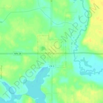
Name: Cyrus topographic map, elevation, terrain.
Location: Cyrus, Pope County, Minnesota, United States (45.61093 -95.74332 45.61929 -95.73273)
Average elevation: 348 m
Minimum elevation: 337 m
Maximum elevation: 360 m
Other topographic maps
Click on a map to view its topography, its elevation and its terrain.
Highest elevation in park
United States > Minnesota > Pope County
Highest elevation in park, 280th Avenue, Pope County, Minnesota, 56381, United States
Average elevation: 379 m