
Thank you for supporting this site ❤️
Make a donation
Make a donation
Watterbach topographic map
Click on the map to display elevation.
Thank you for supporting this site ❤️
Make a donation
Make a donation
About this map
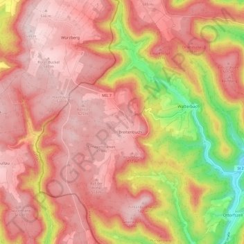
Name: Watterbach topographic map, elevation, terrain.
Location: Watterbach, Kirchzell, Landkreis Miltenberg, Bayern, Deutschland (49.58651 9.06483 49.66056 9.14974)
Average elevation: 432 m
Minimum elevation: 197 m
Maximum elevation: 548 m
Thank you for supporting this site ❤️
Make a donation
Make a donation
Other topographic maps
Click on a map to view its topography, its elevation and its terrain.