
Labenne-Océan topographic map
Interactive map
Click on the map to display elevation.
About this map
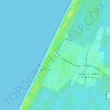
Name: Labenne-Océan topographic map, elevation, terrain.
Average elevation: 3 m
Minimum elevation: 0 m
Maximum elevation: 16 m
Other topographic maps
Click on a map to view its topography, its elevation and its terrain.
Village de Chalets du Boudigau
France > Nouvelle-Aquitaine > Landes > Labenne
Village de Chalets du Boudigau, Labenne, Dax, Landes, Nouvelle-Aquitaine, France métropolitaine, 40530, France
Average elevation: 6 m
Tailleur
France > Nouvelle-Aquitaine > Landes > Labenne
Tailleur, Labenne, Arrondissement de Dax, Landes, Nouvelle-Aquitaine, France métropolitaine, 40530, France
Average elevation: 12 m