
Mesa Grande topographic map
Interactive map
Click on the map to display elevation.
About this map
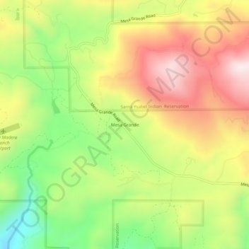
Name: Mesa Grande topographic map, elevation, terrain.
Location: Mesa Grande, San Diego County, California, United States (33.16032 -116.78919 33.20032 -116.74919)
Average elevation: 1,028 m
Minimum elevation: 735 m
Maximum elevation: 1,322 m