
江郎山 topographic map
Interactive map
Click on the map to display elevation.
About this map
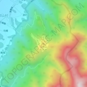
Name: 江郎山 topographic map, elevation, terrain.
Location: 江郎山, 石门, 江山市, 衢州市, 浙江省, 中国 (28.52943 118.56569 28.52953 118.56579)
Average elevation: 435 m
Minimum elevation: 163 m
Maximum elevation: 909 m
江郎山属于典型的晚期高位孤峰型丹霞地貌。三峰自北向南呈“川”字形排列,依次为:郎峰、亚峰、灵峰。其中主峰郎峰海拔816.8米。