
Thank you for supporting this site ❤️
Make a donation
Make a donation
West Paris topographic map
Click on the map to display elevation.
Thank you for supporting this site ❤️
Make a donation
Make a donation
About this map
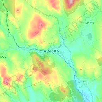
Name: West Paris topographic map, elevation, terrain.
Location: West Paris, Oxford County, Maine, 04289, United States (44.27094 -70.60290 44.37678 -70.45684)
Average elevation: 234 m
Minimum elevation: 109 m
Maximum elevation: 505 m
Thank you for supporting this site ❤️
Make a donation
Make a donation
Other topographic maps
Click on a map to view its topography, its elevation and its terrain.
Thank you for supporting this site ❤️
Make a donation
Make a donation
Thank you for supporting this site ❤️
Make a donation
Make a donation