
Plœuc-sur-Lié topographic map
Interactive map
Click on the map to display elevation.
About this map
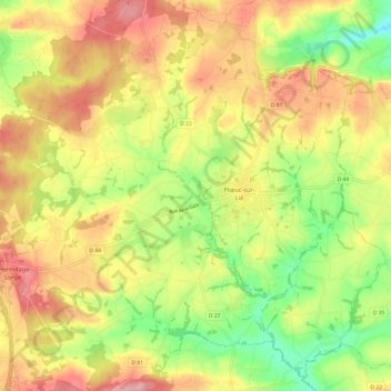
Name: Plœuc-sur-Lié topographic map, elevation, terrain.
Average elevation: 203 m
Minimum elevation: 131 m
Maximum elevation: 271 m
Other topographic maps
Click on a map to view its topography, its elevation and its terrain.
L'Hermitage-Lorge
France > Bretagne > Côtes-d'Armor > Plœuc-L'Hermitage
L'Hermitage-Lorge, Plœuc-L'Hermitage, Saint-Brieuc, Côtes-d'Armor, Bretagne, France métropolitaine, 22150, France
Average elevation: 214 m