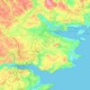
Rønde topographic map
Click on the map to display elevation.
Rønde
Rønde is a hill town, with a 95-meter difference in elevation between the lowest and highest part. This kind of grade difference is unusual for Denmark, where the overall highest point in the country is 172 meters above sea level.
About this map

Name: Rønde topographic map, elevation, terrain.
Average elevation: 31 m
Minimum elevation: -2 m
Maximum elevation: 96 m
Other topographic maps
Click on a map to view its topography, its elevation and its terrain.