
Thank you for supporting this site ❤️
Make a donation
Make a donation
Peer topographic map
Click on the map to display elevation.
Thank you for supporting this site ❤️
Make a donation
Make a donation
About this map
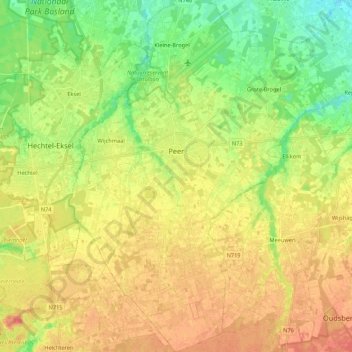
Name: Peer topographic map, elevation, terrain.
Location: Peer, Maaseik, Limburg, Flanders, 3990, Belgium (51.05499 5.38921 51.18950 5.54762)
Average elevation: 63 m
Minimum elevation: 40 m
Maximum elevation: 84 m
Thank you for supporting this site ❤️
Make a donation
Make a donation
Other topographic maps
Click on a map to view its topography, its elevation and its terrain.