
Terregaie topographic map
Interactive map
Click on the map to display elevation.
About this map
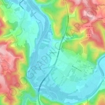
Name: Terregaie topographic map, elevation, terrain.
Average elevation: 163 m
Minimum elevation: 86 m
Maximum elevation: 306 m
Other topographic maps
Click on a map to view its topography, its elevation and its terrain.
Blanzaguet
France > Occitanie > Lot > Pinsac
Blanzaguet, Pinsac, Gourdon, Lot, Occitanie, France métropolitaine, 46200, France
Average elevation: 169 m