
Make a donation
Hoover Dam topographic map
Click on the map to display elevation.
Make a donation
Hoover Dam
The amount of electricity generated by Hoover Dam has been decreasing along with the falling water level in Lake Mead due to the prolonged drought since year 2000 and high demand for the Colorado River's water. By 2014 its generating capacity was downrated by 23% to 1592 MW and was providing power only during periods of peak demand. Lake Mead fell to a new record low elevation of 1,071.61 feet (326.63 m) on July 1, 2016, before beginning to rebound slowly. Under its original design, the dam would no longer be able to generate power once the water level fell below 1,050 feet (320 m), which might have occurred in 2017 had water restrictions not been enforced. To lower the minimum power pool elevation from 1,050 to 950 feet (320 to 290 m), five wide-head turbines, designed to work efficiently with less flow, were installed. Water levels were maintained at over 1,075 feet (328 m) in 2018 and 2019, but fell to a new record low of 1,071.55 feet (326.61 m) on June 10, 2021 and were projected to fall below 1,066 feet (325 m) by the end of 2021.
Make a donation
About this map
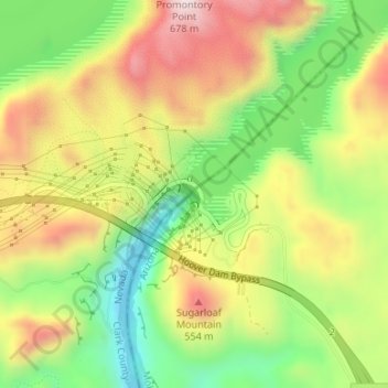
Name: Hoover Dam topographic map, elevation, terrain.
Location: Hoover Dam, Mohave County, Arizona, United States (36.01474 -114.73939 36.01674 -114.73673)
Average elevation: 429 m
Minimum elevation: 197 m
Maximum elevation: 682 m
Make a donation