
Thank you for supporting this site ❤️
Make a donation
Make a donation
Black Nore Lighthouse topographic map
Click on the map to display elevation.
Thank you for supporting this site ❤️
Make a donation
Make a donation
About this map
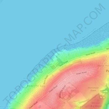
Name: Black Nore Lighthouse topographic map, elevation, terrain.
Average elevation: 30 m
Minimum elevation: 0 m
Maximum elevation: 112 m
Thank you for supporting this site ❤️
Make a donation
Make a donation
Other topographic maps
Click on a map to view its topography, its elevation and its terrain.
Portishead Quays Marina
United Kingdom > England > North Somerset > Portishead > North Weston
Average elevation: 11 m