
Daftah topographic map
Interactive map
Click on the map to display elevation.
About this map
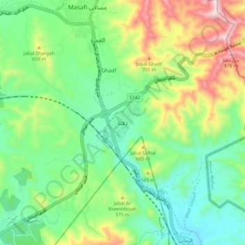
Name: Daftah topographic map, elevation, terrain.
Location: Daftah, Fujairah Emirate, United Arab Emirates (25.22715 56.13784 25.30715 56.21784)
Average elevation: 473 m
Minimum elevation: 241 m
Maximum elevation: 949 m
Other topographic maps
Click on a map to view its topography, its elevation and its terrain.