
St Albans topographic map
Interactive map
Click on the map to display elevation.
About this map
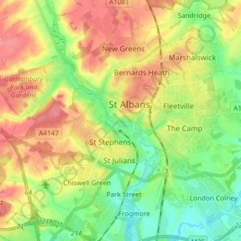
Name: St Albans topographic map, elevation, terrain.
Location: St Albans, Hertfordshire, East of England, Engeland, VK (51.71053 -0.37517 51.78547 -0.25823)
Average elevation: 100 m
Minimum elevation: 64 m
Maximum elevation: 141 m