
Thank you for supporting this site ❤️
Make a donation
Make a donation
Kopaonik topographic map
Click on the map to display elevation.
Thank you for supporting this site ❤️
Make a donation
Make a donation
Kopaonik
Kopaonik (Serbian Cyrillic: Копаоник; Albanian: Kopaoniku) is a mountain range located in Kosovo and Serbia. The highest point of this mountain range is the Pančić's Peak with an altitude of 2,017 m (6,617 ft). The central part of the Kopaonik plateau was declared a national park in 1981 which today covers an area of 121.06 km2 (46.74 sq mi).
Thank you for supporting this site ❤️
Make a donation
Make a donation
About this map
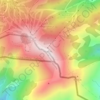
Name: Kopaonik topographic map, elevation, terrain.
Average elevation: 1,733 m
Minimum elevation: 1,334 m
Maximum elevation: 2,004 m
Thank you for supporting this site ❤️
Make a donation
Make a donation
Other topographic maps
Click on a map to view its topography, its elevation and its terrain.