
Mount Willard topographic map
Interactive map
Click on the map to display elevation.
About this map
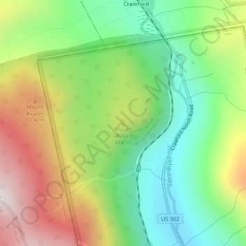
Name: Mount Willard topographic map, elevation, terrain.
Average elevation: 775 m
Minimum elevation: 417 m
Maximum elevation: 1,297 m
Other topographic maps
Click on a map to view its topography, its elevation and its terrain.
Sawyers River
United States > New Hampshire > Carroll County > Hart's Location
Sawyers River, Hart's Location, Carroll County, New Hampshire, United States
Average elevation: 457 m
Crawford Notch State Park
United States > New Hampshire > Carroll County > Hart's Location
Crawford Notch State Park, Hart's Location, Carroll County, New Hampshire, United States
Average elevation: 796 m