
Thank you for supporting this site ❤️
Make a donation
Make a donation
Tambopata National Reserve topographic map
Click on the map to display elevation.
Thank you for supporting this site ❤️
Make a donation
Make a donation
Tambopata National Reserve
The area consists of forested hills and plains, with elevations ranging from 200 to 400 m above sea level.[3] The area presents swamps, oxbow lakes and meandering rivers; the main rivers in the reserve being the Tambopata, Malinowski and Heath rivers.[3]
Thank you for supporting this site ❤️
Make a donation
Make a donation
About this map
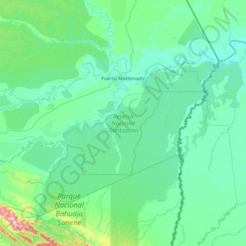
Name: Tambopata National Reserve topographic map, elevation, terrain.
Location: Tambopata National Reserve, Madre de Dios, Peru (-13.17306 -70.09986 -12.50385 -68.73176)
Average elevation: 239 m
Minimum elevation: 152 m
Maximum elevation: 1,245 m
Thank you for supporting this site ❤️
Make a donation
Make a donation
Other topographic maps
Click on a map to view its topography, its elevation and its terrain.