
Thank you for supporting this site ❤️
Make a donation
Make a donation
Reuth topographic map
Click on the map to display elevation.
Thank you for supporting this site ❤️
Make a donation
Make a donation
Reuth
Das Pfarrdorf in der naturräumlichen Landschaftseinheit des Regnitztals liegt etwa vier Kilometer östlich des Ortszentrums von Forchheim auf einer Höhe von 332 m ü. NHN und ist mit dem Siedlungsgebiet von Forchheim zusammengewachsen.
Thank you for supporting this site ❤️
Make a donation
Make a donation
About this map
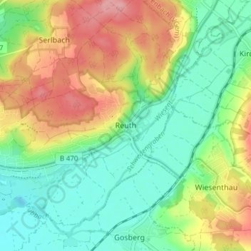
Name: Reuth topographic map, elevation, terrain.
Average elevation: 304 m
Minimum elevation: 260 m
Maximum elevation: 370 m
Thank you for supporting this site ❤️
Make a donation
Make a donation