
八十亩地 topographic map
Interactive map
Click on the map to display elevation.
About this map
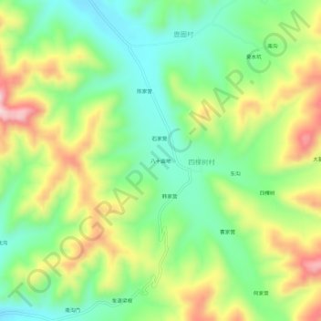
Name: 八十亩地 topographic map, elevation, terrain.
Location: 八十亩地, 围场满族蒙古族自治县, 承德市, 河北省, 中国 (41.76732 117.86022 41.80732 117.90022)
Average elevation: 948 m
Minimum elevation: 821 m
Maximum elevation: 1,142 m
Other topographic maps
Click on a map to view its topography, its elevation and its terrain.