
Sanavastre topographic map
Interactive map
Click on the map to display elevation.
About this map
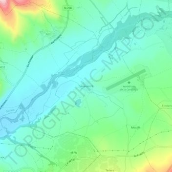
Name: Sanavastre topographic map, elevation, terrain.
Location: Sanavastre, Das, Cerdaña, Gerona, Cataluña, 17539, España (42.36552 1.83052 42.40552 1.87052)
Average elevation: 1,091 m
Minimum elevation: 1,033 m
Maximum elevation: 1,274 m
Other topographic maps
Click on a map to view its topography, its elevation and its terrain.