
Abdelaziz topographic map
Interactive map
Click on the map to display elevation.
About this map
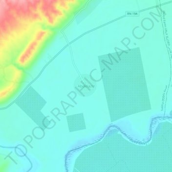
Name: Abdelaziz topographic map, elevation, terrain.
Location: Abdelaziz, Sobha, Daïra Boukadir, Chlef, Algérie (36.12101 1.12794 36.16101 1.16794)
Average elevation: 91 m
Minimum elevation: 68 m
Maximum elevation: 185 m
Other topographic maps
Click on a map to view its topography, its elevation and its terrain.
Oued Sly
Algérie > Chlef > Daïra Boukadir
Oued Sly, Daïra Boukadir, Chlef, 02011, Algérie
Average elevation: 163 m
Boukadir
Algérie > Chlef > Daïra Boukadir
Boukadir, Daïra Boukadir, Chlef, Algérie
Average elevation: 263 m