
Thank you for supporting this site ❤️
Make a donation
Make a donation
Bateman topographic map
Click on the map to display elevation.
Thank you for supporting this site ❤️
Make a donation
Make a donation
About this map
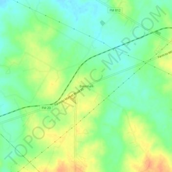
Name: Bateman topographic map, elevation, terrain.
Location: Bateman, Bastrop County, Texas, 78662, United States (29.93133 -97.49527 29.97133 -97.45527)
Average elevation: 146 m
Minimum elevation: 128 m
Maximum elevation: 168 m
Thank you for supporting this site ❤️
Make a donation
Make a donation
Other topographic maps
Click on a map to view its topography, its elevation and its terrain.