
Cleveland topographic map
Click on the map to display elevation.
About this map
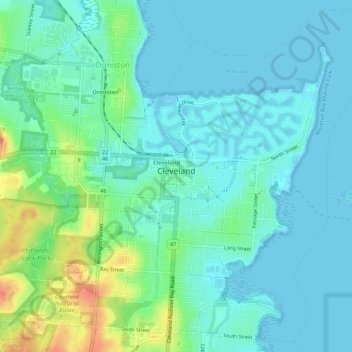
Name: Cleveland topographic map, elevation, terrain.
Location: Cleveland, Redland City, Queensland, 4163, Australia (-27.54972 153.24218 -27.50435 153.29633)
Average elevation: 12 m
Minimum elevation: -2 m
Maximum elevation: 49 m
Other topographic maps
Click on a map to view its topography, its elevation and its terrain.