
Thank you for supporting this site ❤️
Make a donation
Make a donation
Bhadrak Rural topographic map
Click on the map to display elevation.
Thank you for supporting this site ❤️
Make a donation
Make a donation
About this map
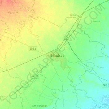
Name: Bhadrak Rural topographic map, elevation, terrain.
Location: Bhadrak Rural, Bhadrak, Odisha, India (20.96809 86.35943 21.16220 86.65672)
Average elevation: 16 m
Minimum elevation: 2 m
Maximum elevation: 41 m
Thank you for supporting this site ❤️
Make a donation
Make a donation
Other topographic maps
Click on a map to view its topography, its elevation and its terrain.