
Thank you for supporting this site ❤️
Make a donation
Make a donation
Vilarinho topographic map
Click on the map to display elevation.
Thank you for supporting this site ❤️
Make a donation
Make a donation
About this map
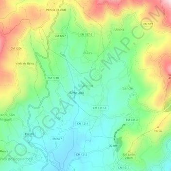
Name: Vilarinho topographic map, elevation, terrain.
Location: Vilarinho, Vila Verde, Braga, 4730-400, Portugal (41.68445 -8.42837 41.72445 -8.38837)
Average elevation: 211 m
Minimum elevation: 58 m
Maximum elevation: 497 m
Thank you for supporting this site ❤️
Make a donation
Make a donation
Other topographic maps
Click on a map to view its topography, its elevation and its terrain.