
Thank you for supporting this site ❤️
Make a donation
Make a donation
Lake City topographic map
Click on the map to display elevation.
Thank you for supporting this site ❤️
Make a donation
Make a donation
About this map
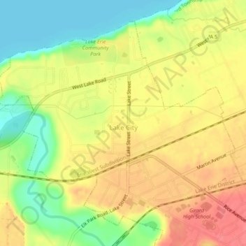
Name: Lake City topographic map, elevation, terrain.
Location: Lake City, Erie County, Pennsylvania, 16423, United States (42.00671 -80.36701 42.03181 -80.32642)
Average elevation: 208 m
Minimum elevation: 172 m
Maximum elevation: 237 m
Thank you for supporting this site ❤️
Make a donation
Make a donation
Other topographic maps
Click on a map to view its topography, its elevation and its terrain.