
Magenta topographic map
Interactive map
Click on the map to display elevation.
About this map
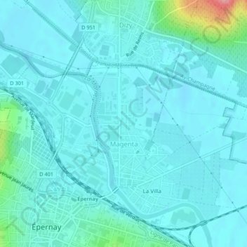
Name: Magenta topographic map, elevation, terrain.
Average elevation: 78 m
Minimum elevation: 64 m
Maximum elevation: 175 m
Other topographic maps
Click on a map to view its topography, its elevation and its terrain.
Brusson
Francia > Grande Est > Marna
Brusson, Vitry-le-François, Marna, Grande Est, Francia metropolitana, 51300, Francia
Average elevation: 108 m