
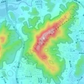
岳麓山 topographic map
Interactive map
Click on the map to display elevation.
About this map
Name: 岳麓山 topographic map, elevation, terrain.
Location: 岳麓山, 新民路, 岳麓街道, 长沙市, 岳麓区, 长沙市, 湖南省, 430038, 中国 (28.17041 112.91790 28.20346 112.94347)
Average elevation: 94 m
Minimum elevation: 28 m
Maximum elevation: 293 m
Other topographic maps
Click on a map to view its topography, its elevation and its terrain.