
阿拉善 topographic map
Interactive map
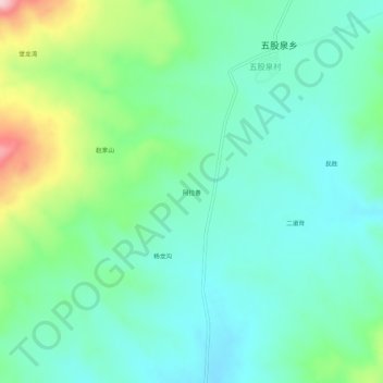
Click on the map to display elevation.
About this map
Name: 阿拉善 topographic map, elevation, terrain.
Location: 阿拉善, 五股泉乡, 兴和县, 乌兰察布市, 内蒙古自治区, 中国 (41.17891 113.61444 41.21891 113.65444)
Average elevation: 1,488 m
Minimum elevation: 1,432 m
Maximum elevation: 1,648 m
Other topographic maps
Click on a map to view its topography, its elevation and its terrain.