
Valmir topographic map
Interactive map
Click on the map to display elevation.
About this map
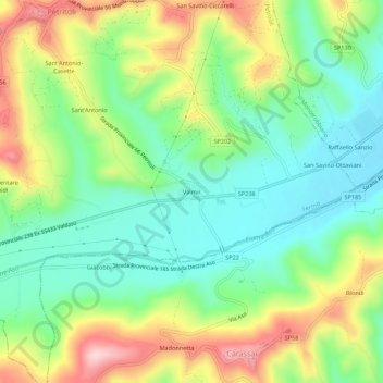
Name: Valmir topographic map, elevation, terrain.
Location: Valmir, FM, Marcas, 63048, Itália (43.02890 13.65782 43.06890 13.69782)
Average elevation: 205 m
Minimum elevation: 105 m
Maximum elevation: 373 m