
Bosguérard-de-Marcouville topographic map
Interactive map
Click on the map to display elevation.
About this map
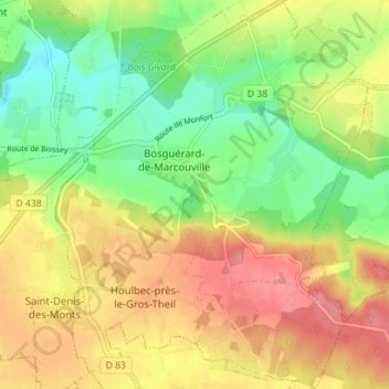
Name: Bosguérard-de-Marcouville topographic map, elevation, terrain.
Average elevation: 138 m
Minimum elevation: 96 m
Maximum elevation: 180 m
Other topographic maps
Click on a map to view its topography, its elevation and its terrain.
Berville-en-Roumois
France > Normandie > Eure > Les Monts du Roumois
Berville-en-Roumois, Les Monts du Roumois, Bernay, Eure, Normandie, France métropolitaine, 27520, France
Average elevation: 131 m