
Puerto Suarez topographic map
Interactive map
Click on the map to display elevation.
About this map
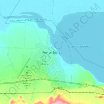
Name: Puerto Suarez topographic map, elevation, terrain.
Location: Puerto Suarez, Provincia German Busch, SCZ, Bolivia (-19.00288 -57.83739 -18.92288 -57.75739)
Average elevation: 106 m
Minimum elevation: 81 m
Maximum elevation: 228 m