
Ordicia topographic map
Interactive map
Click on the map to display elevation.
About this map
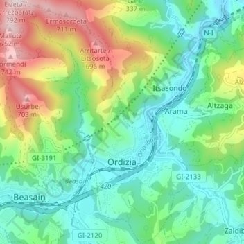
Name: Ordicia topographic map, elevation, terrain.
Location: Ordicia, Goyerri, Guipúzcoa, País Vasco, 20240, España (43.03853 -2.20611 43.08425 -2.16168)
Average elevation: 315 m
Minimum elevation: 118 m
Maximum elevation: 761 m