
Thank you for supporting this site ❤️
Make a donation
Make a donation
La Rimière topographic map
Click on the map to display elevation.
Thank you for supporting this site ❤️
Make a donation
Make a donation
About this map
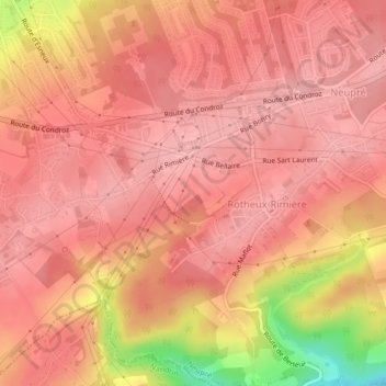
Name: La Rimière topographic map, elevation, terrain.
Location: La Rimière, Neupré, Liège, Wallonie, 4120, Belgique (50.52610 5.46304 50.54610 5.48304)
Average elevation: 246 m
Minimum elevation: 153 m
Maximum elevation: 271 m
Thank you for supporting this site ❤️
Make a donation
Make a donation
Other topographic maps
Click on a map to view its topography, its elevation and its terrain.