
Ebenheid topographic map
Interactive map
Click on the map to display elevation.
About this map
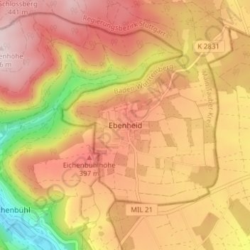
Name: Ebenheid topographic map, elevation, terrain.
Average elevation: 346 m
Minimum elevation: 154 m
Maximum elevation: 467 m
Other topographic maps
Click on a map to view its topography, its elevation and its terrain.
Freudenberg
Deutschland > Baden-Württemberg > Main-Tauber-Kreis > Freudenberg
Freudenberg, Main-Tauber-Kreis, Baden-Württemberg, 97896, Deutschland
Average elevation: 291 m