
彭埠街道 topographic map
Interactive map
Click on the map to display elevation.
About this map
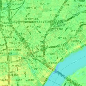
Name: 彭埠街道 topographic map, elevation, terrain.
Location: 彭埠街道, 上城区, 杭州市, 浙江省, 310017, 中国 (30.26581 120.19533 30.31989 120.26746)
Average elevation: 9 m
Minimum elevation: -1 m
Maximum elevation: 17 m
Other topographic maps
Click on a map to view its topography, its elevation and its terrain.
民国国立浙江图书馆(现大学路馆舍)
民国国立浙江图书馆(现大学路馆舍), 大学路社区, 小营街道, 上城区, 杭州市, 浙江省, 中国
Average elevation: 16 m