
El Cantillo topographic map
Interactive map
Click on the map to display elevation.
About this map
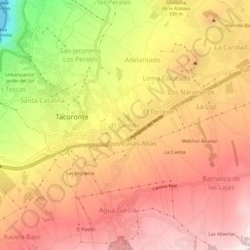
Name: El Cantillo topographic map, elevation, terrain.
Average elevation: 589 m
Minimum elevation: 0 m
Maximum elevation: 950 m
Other topographic maps
Click on a map to view its topography, its elevation and its terrain.
Urbanización Jardín del Sol
España > Tacoronte > Urbanización Jardín del Sol
Urbanización Jardín del Sol, Tacoronte, Santa Cruz de Tenerife, Canarias, 38350, España
Average elevation: 309 m