
Mariahilfberg topographic map
Interactive map
Click on the map to display elevation.
About this map
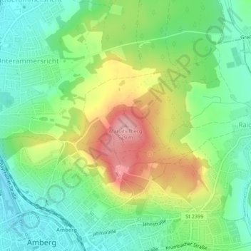
Name: Mariahilfberg topographic map, elevation, terrain.
Location: Mariahilfberg, Amberg, Bayern, 92224, Deutschland (49.45793 11.87255 49.45803 11.87265)
Average elevation: 429 m
Minimum elevation: 372 m
Maximum elevation: 523 m
Other topographic maps
Click on a map to view its topography, its elevation and its terrain.