
Thank you for supporting this site ❤️
Make a donation
Make a donation
Columbiana topographic map
Click on the map to display elevation.
Thank you for supporting this site ❤️
Make a donation
Make a donation
About this map
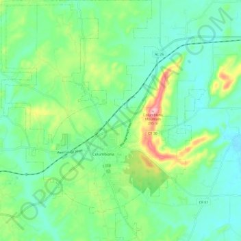
Name: Columbiana topographic map, elevation, terrain.
Location: Columbiana, Shelby County, Alabama, 35051, United States (33.14293 -86.71396 33.24148 -86.55685)
Average elevation: 167 m
Minimum elevation: 120 m
Maximum elevation: 289 m
Thank you for supporting this site ❤️
Make a donation
Make a donation
Other topographic maps
Click on a map to view its topography, its elevation and its terrain.
Thank you for supporting this site ❤️
Make a donation
Make a donation
Thank you for supporting this site ❤️
Make a donation
Make a donation