
Stapel topographic map
Interactive map
Click on the map to display elevation.
About this map
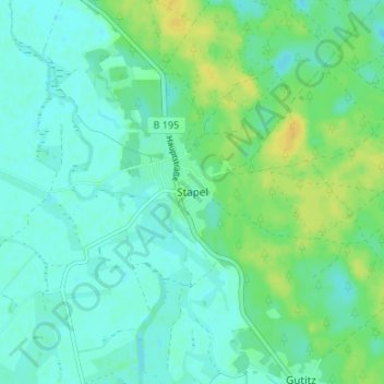
Name: Stapel topographic map, elevation, terrain.
Location: Stapel, Lüneburg, Niedersachsen, Deutschland (53.23250 10.94135 53.27250 10.98135)
Average elevation: 14 m
Minimum elevation: 7 m
Maximum elevation: 28 m