
Klein Süntel topographic map
Interactive map
Click on the map to display elevation.
About this map
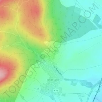
Name: Klein Süntel topographic map, elevation, terrain.
Average elevation: 153 m
Minimum elevation: 94 m
Maximum elevation: 269 m
Other topographic maps
Click on a map to view its topography, its elevation and its terrain.
Bakede
Deutschland > Niedersachsen > Landkreis Hameln-Pyrmont > Bad Münder > Bakede
Bakede, Bad Münder, Landkreis Hameln-Pyrmont, Niedersachsen, 31848, Deutschland
Average elevation: 191 m