
Afir topographic map
Interactive map
Click on the map to display elevation.
About this map
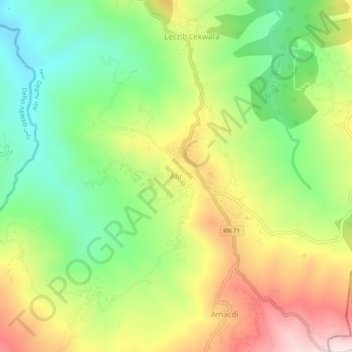
Name: Afir topographic map, elevation, terrain.
Location: Afir, Daïra Dellys, Boumerdès, 35032, Algérie (36.82234 3.96715 36.86234 4.00715)
Average elevation: 306 m
Minimum elevation: 87 m
Maximum elevation: 596 m