
Thank you for supporting this site ❤️
Make a donation
Make a donation
Ghislenghien topographic map
Click on the map to display elevation.
Thank you for supporting this site ❤️
Make a donation
Make a donation
About this map
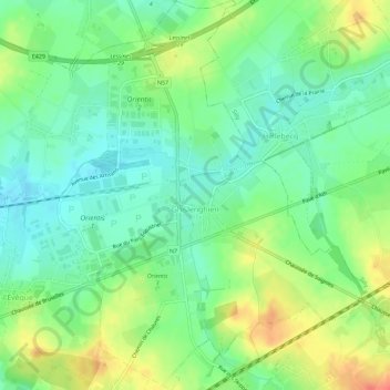
Name: Ghislenghien topographic map, elevation, terrain.
Location: Ghislenghien, Ath, Hainaut, Wallonie, Belgique (50.63995 3.85591 50.67601 3.90051)
Average elevation: 48 m
Minimum elevation: 28 m
Maximum elevation: 78 m
Thank you for supporting this site ❤️
Make a donation
Make a donation
Other topographic maps
Click on a map to view its topography, its elevation and its terrain.