
Make a donation
Mykonos topographic map
Click on the map to display elevation.
Make a donation
Mykonos
Mykonos (/ˈmɪkənɒs, -noʊs/, UK also /ˈmiːk-/; Greek: Μύκονος [ˈmikonos]) is a Greek island, part of the Cyclades, lying between Tinos, Syros, Paros and Naxos. The island has an area of 85.5 square kilometres (33.0 sq mi) and rises to an elevation of 341 metres (1,119 feet) at its highest point. There are 10,134 inhabitants according to the 2011 census, most of whom live in the largest town, Mykonos, which lies on the west coast. The town is also known as Chora (i.e. 'Town' in Greek, following the common practice in Greece when the name of the island itself is the same as the name of the principal town).
Make a donation
About this map
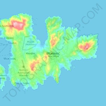
Name: Mykonos topographic map, elevation, terrain.
Average elevation: 38 m
Minimum elevation: -1 m
Maximum elevation: 372 m
Make a donation