
Thank you for supporting this site ❤️
Make a donation
Make a donation
Leoben topographic map
Click on the map to display elevation.
Thank you for supporting this site ❤️
Make a donation
Make a donation
About this map
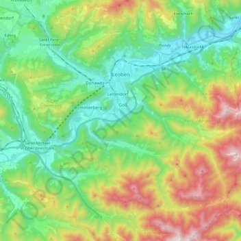
Name: Leoben topographic map, elevation, terrain.
Location: Leoben, Bezirk Leoben, Styria, Austria (47.28043 15.02718 47.42461 15.23230)
Average elevation: 871 m
Minimum elevation: 493 m
Maximum elevation: 1,639 m
Thank you for supporting this site ❤️
Make a donation
Make a donation