
Thank you for supporting this site ❤️
Make a donation
Make a donation
Wiscasset topographic map
Click on the map to display elevation.
Thank you for supporting this site ❤️
Make a donation
Make a donation
About this map
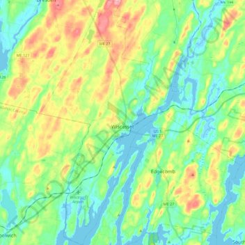
Name: Wiscasset topographic map, elevation, terrain.
Location: Wiscasset, Lincoln County, Maine, 04578, United States (43.92726 -69.74633 44.08815 -69.62364)
Average elevation: 35 m
Minimum elevation: -9 m
Maximum elevation: 109 m
Thank you for supporting this site ❤️
Make a donation
Make a donation
Other topographic maps
Click on a map to view its topography, its elevation and its terrain.
Thank you for supporting this site ❤️
Make a donation
Make a donation
Monhegan Island
United States > Maine > Lincoln County > Monhegan Island Plantation > Monhegan
Average elevation: 5 m
Thank you for supporting this site ❤️
Make a donation
Make a donation