
Thank you for supporting this site ❤️
Make a donation
Make a donation
Tarmount topographic map
Click on the map to display elevation.
Thank you for supporting this site ❤️
Make a donation
Make a donation
About this map
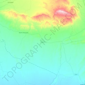
Name: Tarmount topographic map, elevation, terrain.
Location: Tarmount, Hammam Delaa District, M'Sila, Algeria (35.74915 4.14530 35.88573 4.36595)
Average elevation: 640 m
Minimum elevation: 473 m
Maximum elevation: 1,240 m
Thank you for supporting this site ❤️
Make a donation
Make a donation
Other topographic maps
Click on a map to view its topography, its elevation and its terrain.