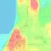
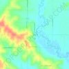
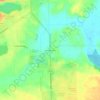
Marquette County topographic map
Click on the map to display elevation.
Marquette County
Marquette County lies in central Wisconsin’s glaciated lowland-and-moraine country, where a generally subdued landscape is broken by sandy outwash plains, wet basins, lake margins, and low ridges left by Ice Age ice and meltwater. Elevations are modest but varied, from the broad, lower wetlands and waterways around the Fox River, Mecan River, White River, Buffalo Lake, and Lake Puckaway to higher, rolling uplands toward the west and northwest, including moraine-like ridges and isolated knobs that rise above the surrounding farmland and marshy flats. Much of the county has a gently undulating physical character, with shallow relief, drainage swales, small lakes, and peat- or marsh-lined depressions, while the western side becomes more irregular where the terrain grades toward higher sandy and rocky uplands near Adams County and the Wisconsin River country. Overall, Marquette County’s topography is defined less by steep slopes than by subtle glacial contrasts: open agricultural plains, low wooded rises, stream valleys, lake basins, and scattered high points that give the landscape a softly rolling, water-rich, and distinctly central-Wisconsin character.
About this map

Name: Marquette County topographic map, elevation, terrain.
Location: Marquette County, Wisconsin, United States (43.64258 -89.59963 43.98291 -89.16793)
Average elevation: 259 m
Minimum elevation: 231 m
Maximum elevation: 393 m
Other topographic maps
Click on a map to view its topography, its elevation and its terrain.



Madison
United States > Wisconsin > Dane County
The city is sometimes described as The City of Four Lakes, comprising the four successive lakes of the Yahara River: Lake Mendota ("Fourth Lake"), Lake Monona ("Third Lake"), Lake Waubesa ("Second Lake") and Lake Kegonsa ("First Lake"), although Waubesa and Kegonsa are not actually in Madison, but just south…
Average elevation: 289 m
Mississippi River
United States > Wisconsin > Grant County > Dubuque
The uppermost lock and dam on the Upper Mississippi River is the Upper St. Anthony Falls Lock and Dam in Minneapolis. Above the dam, the river's elevation is 799 feet (244 m). Below the dam, the river's elevation is 750 feet (230 m). This 49-foot (15 m) drop is the largest of all the Mississippi River locks…
Average elevation: 203 m

Glacial Valley Park
United States > Wisconsin > Dane County > Village of Cross Plains
Average elevation: 287 m
Lead Mine
United States > Wisconsin > Lafayette County > Town of New Diggings
Average elevation: 264 m
Calumet County Park
United States > Wisconsin > Calumet County > Rockaway Beach
Average elevation: 257 m

Danbury
United States > Wisconsin > Burnett County
Danbury is located at 46.006N. The longitude is -92.371W. It is in the Central Standard Time Zone. The elevation is 938 feet (286 m) above sea level.
Average elevation: 287 m

Depere Lock and Dam
United States > Wisconsin > Brown County > De Pere > West De Pere
Average elevation: 186 m