
Le Petit Sancerre topographic map
Interactive map
Click on the map to display elevation.
About this map
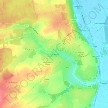
Name: Le Petit Sancerre topographic map, elevation, terrain.
Average elevation: 174 m
Minimum elevation: 140 m
Maximum elevation: 210 m
Other topographic maps
Click on a map to view its topography, its elevation and its terrain.
Les Fouchards
France > Centre-Val de Loire > Cher > Boulleret > Les Fouchards
Les Fouchards, Boulleret, Bourges, Cher, Centre-Val de Loire, France métropolitaine, 18240, France
Average elevation: 158 m