
Maori Lakes topographic map
Interactive map
Click on the map to display elevation.
About this map
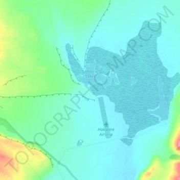
Name: Maori Lakes topographic map, elevation, terrain.
Location: Maori Lakes, Ashburton District, Canterbury, Nuova Zelanda (-43.57701 171.16493 -43.56777 171.18376)
Average elevation: 640 m
Minimum elevation: 618 m
Maximum elevation: 717 m
Other topographic maps
Click on a map to view its topography, its elevation and its terrain.
Isola del Sud
Isola del Sud, Ashburton District, Canterbury, Nuova Zelanda
Average elevation: 201 m